Meeting
21-22/06/2003
(23/12/08
)
Organised by the RSSOC in Belgium
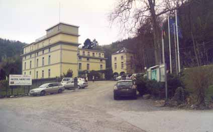
Place to be: http://www.hotels-belgium.com/Dinant/mercure.htm
What you'll see


|
Ardennes - Dinant - Condroz We often mention "The Ardennes" referring to the Southern part of Belgium; where the land isn't "flat" anymore. The real Ardennes are "far" South of Dinant, i.e. South of the line Stavelot -La Roche-Saint-Hubert. (This to say if in Belgium a distance can be "far".) Main towns in The Ardennes are Bastogne (Nuts City), Recogne, Neufchateau, Saint-Hubert, Houffalize, (Arlon). In those regions one is often confronted with Sherman-tanks parked at the side of the road, telling the traveller that in last war there's been quite some fighting here. On the Saturday-trip we'll reach the Ardennes, the Sunday-trip will be purely Condroz. For the meeting we didn't find enough free rooms in The Ardennes. We 've found a good place in Dinant but the correct name for the region between Samber-Meuse and a parallel line some 30 miles South is "Condroz." Condroz The name is first mentioned by Julius Ceasar in "De Bello Gallico". He's had some troubles with a tribe he called "Condruzi". The North frontier
of the Condroz is constituted by the straight line of the valleys of
Samber & Meuse. The region South of
this gully is special by the fact that the originally horizontal
sedimental-layers of Cambri-Silurian and Devon-Carbon where folded
(Hercynian folding) in such a way that they were sticking-up vertically in
a young mountain range.
On the (Michelin) map we see at different places, old meanders of the Meuse. At Profondeville (half between Dinant and Namur) one sees a small white loop on the left (West) bank. This loop, thirty meters above the current level of the Meuse is an old meander, cut through and abandoned probably during an ice-age. Up there pebbles are found that rolled here from the North of France. |
|
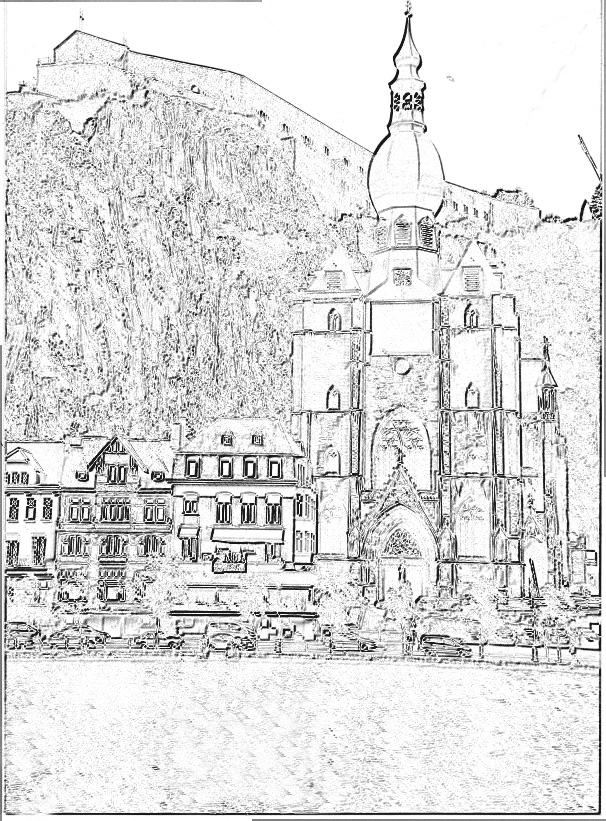
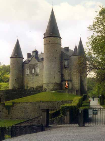
Dinant: The name comes from
a mans name Theotnant (Gods-servant)(founder?). First bridge was built in 1080 but from 1175 to 1940 it is frequently destroyed by man or by ice or by floads, current construction dates from 1957 (Charles De Gaulle was injured here during the great war). The citadel, 121m above the Meuse was an excellent spot to master the region and the bridge. In 1051 a first stronghold was built, destroyed and rebuilt several times. In 1466 the citadel was destroyed and 800 inhabitants of Dinant where tightened back to back thrown in the Meuse.The Franch (Louis XIV) conquered the citadel in 1675, Vauban reconstructed the citadel but had to demolish it again in 1703 because Dinant was given back to the North by agreement. The current construction was built by the Dutch (1815-1830), to prevent an
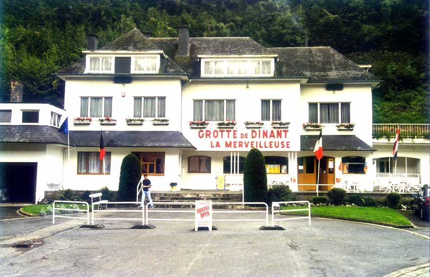
invasion from France. Military importance stopped 1865. Cave La
Merveilleuse "the marvellous" discovered in 1904 by works on
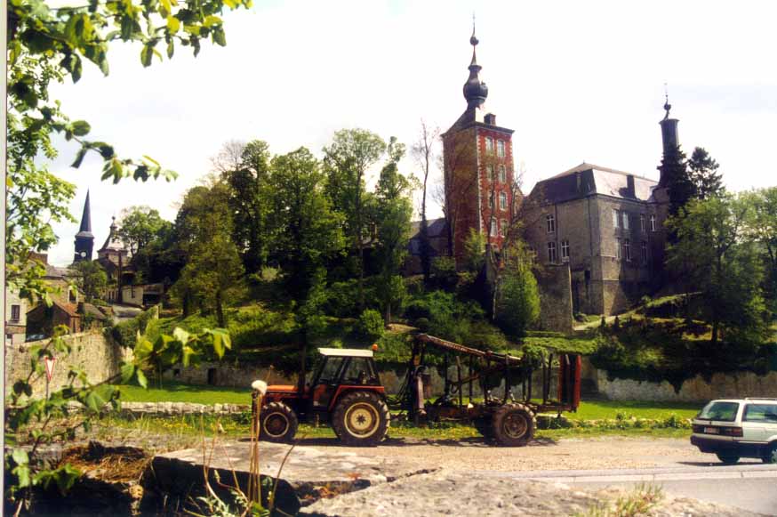
a railway. Yvoir inhabited
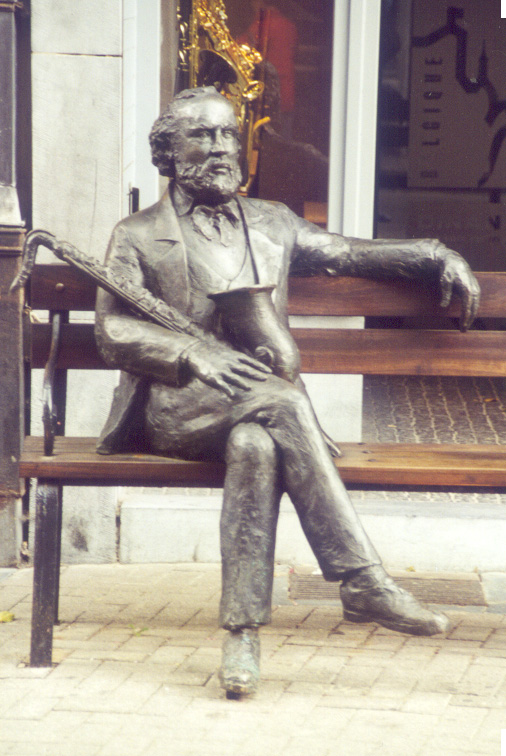
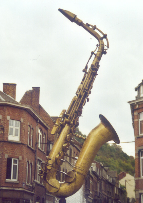
since Gallo-Roman times, iron-industry (then). Adolphe Sax (Antoine
Joseph Sax) °06/11/1814 in Dinant +04/02/1894
Parijs. Couques de Dinant: inhabitants are proud of them (raised on them?) Is a nougat-like titbit made with as only ingredients wheat-flower and honey, baken in an oven. Chocolate: In the Rue Adolphe Sax - 10 is a Leonidas-shop; reknown over here for their good chocolate. From the hotel.... drive to the centre, past Roche Bayard, past the fuel-station following the "Rue Grande" and in front of the church don't cross the Meuse but carry on on the right bank direction North. This is rue Adolphe Sax (One way). Turn twice left to get back.
|

Information copied from Slicemart
|
ARDENNES INTERNATIONAL 2003 |
|
The Reliant Sabre and Scimitar
Owners'Club |
|
Guests will arrive on Friday June 20, the Scimitar Rally will take place on Saturday, and there will be a traditional excursion on Sunday. Our headquarters during the International Meeting will be the Hotel Mercure Dinant in the province of Namur. As a guide, this is around 250 miles from central London and is an easy journey from southern England, or might require a stopover for those travelling from the north. Dinant is easily reached via the Belgian motorway network from all directions. The weekend prices are shown on the booking form on page 11. Overseas Members should pay direct to the RSSOC in the UK by credit card (subject to a 5% surcharge), or direct to our Euro account in Beigium. Accommodation is in an en-suite room including breakfast. Saturday night dinner includes drinks. Extra nights are availabie. |
Best way to get to Dinant - Hotel Mercure
is : coming from the UK getting on the E19-E42 near "Mons".
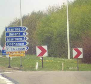
Coming from the West: if you didn't follow the E42-E411 but took minor roads to enjoy the Belgian weather? You get off the N97 where you see exit "Neufchateau Le Lesse Celles Dinant"
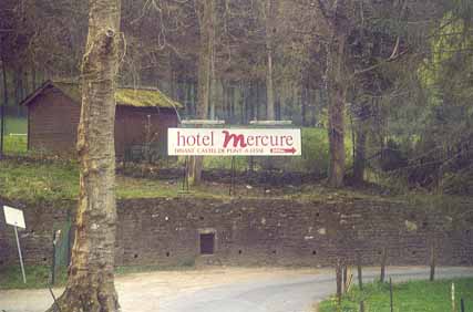
You see "Mercure" on the yellow signs. |
|
To prepare you for the next days: The sign, yellow background, red rim, black letters simply mean that you're entering the territory of that community. Has nothing to do with speed-limits the same sign with white background means speed-limit to 50km/h. Brown background and white text gives tourist information. To prepare you for the next km: take third gear cause it goes down and down.
|
|
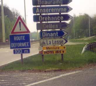
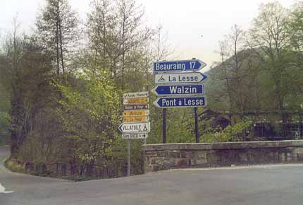
Left on the "T" crossing at the right bank of the Meuse Then left-down before the right-turn at the bridge over the Lesse
"Mercure" allways on the signs. |
|
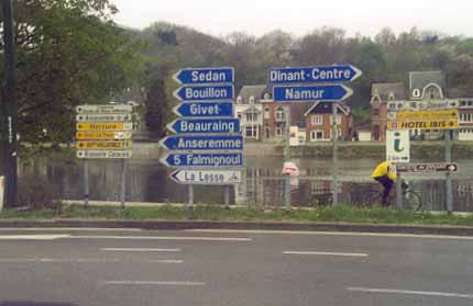
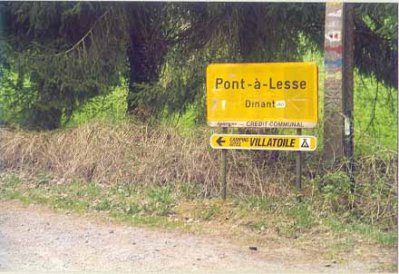
"Mercure" is gone?..... Did we miss it???
|
| Not indeed:
|
|
Best way to get to Dinant - Hotel Mercure is : coming from the UK
getting on the E19-E42 near "Mons".
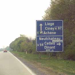
Then following the E42 to the East, past Charleroi, past Namur until you reach the highway-crossing between E42 and E411. The E411 is running North-South so perhaps from here you'll see some English cars with Dutch numberplate. Take the E411 to the South, direction Arlon - Luxemburg; near Achêne you leave the E411 by exit 20 Immediately (automatically) engage here on the N97 direction "Philippeville" - Mercure is on the yellow signs from here. Don't take the first exit "Dinant" here! The N97, is merely a highway-bridge over the Meuse. Coming from the East (or from the E411 !before you cross the Meuse!) you'll see exit "Beauraing N94 Anseremme La Lesse Dinant +5 1/2t": This is where you leave the highway. Coming from the West: if you didn't follow the E42-E411 but took minor roads to enjoy the Belgian weather? You get off the N97 where you see exit "Neufchateau La Lesse Celles Dinant" - rrrrrrrr just after you crossed the Meuse. Now follow Dinant, it's easy, down to the Meuse is the right direction. You 'll see "Mercure" on the yellow signs. Left on the "T" crossing at the right bank of the Meuse. (Dinant is to the right here! Straightforward means swimming!) However, if you should be low on fuel you could go right, direction Dinant Centrum, pass between Roche Bayard and attend to a gas-station on your left. It's promised to be manned from 8 am to 8 pm. Don't know what Belgian card-readers do with non-continental cards. It's the nearest we could find. If you turn back before the gas-station, and have remembered where you took the wrong direction... Don't seek to pass through Rock Bayard coming back.. it's one-way. Then again left-down before (in) the right-turn, just before the bridge over the Lesse, always following Mercure-signs. Just follow the Lesse now. Look out, a naughty man has left something in the middle of the road that has been damaged by quite some cars with smaller ground-clearance. "Mercure" allways on the yellow signs. |


Sabra (Startpage)